What are digital twins, and how can you use them to your advantage?
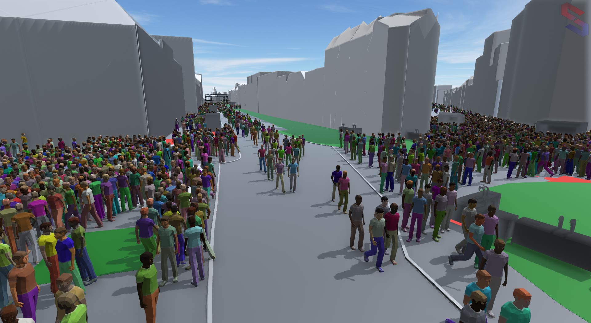
Digital twin cities are becoming increasingly popular as a way to manage urban environments. But what are they, and how can you use them to your advantage? A digital twin is a translation of the physical space into a detailed 3D digital environment that can be used for planning, analysis, and decision-making. The twin is constantly updated with data from the actual city, so it provides an accurate representation of the current state of the space. Nijmegen is one of the first cities in the Netherlands to use digital twin technology to improve the safety and organization of its events. In particular, their fieldlab is taking steps to blend the GIS, CAD and gaming worlds, enabling an interactive 3D representation of the city of Nijmegen enriched with event obstacles (such as tents, fences and podiums). To map Nijmegen and construct this digital environment, various data and different systems need to be linked. After the digital twin is complete, it can be used to simulate various scenarios, such as different traffic patterns, large-scale events that attract large crowds, or the effects of a natural disaster.
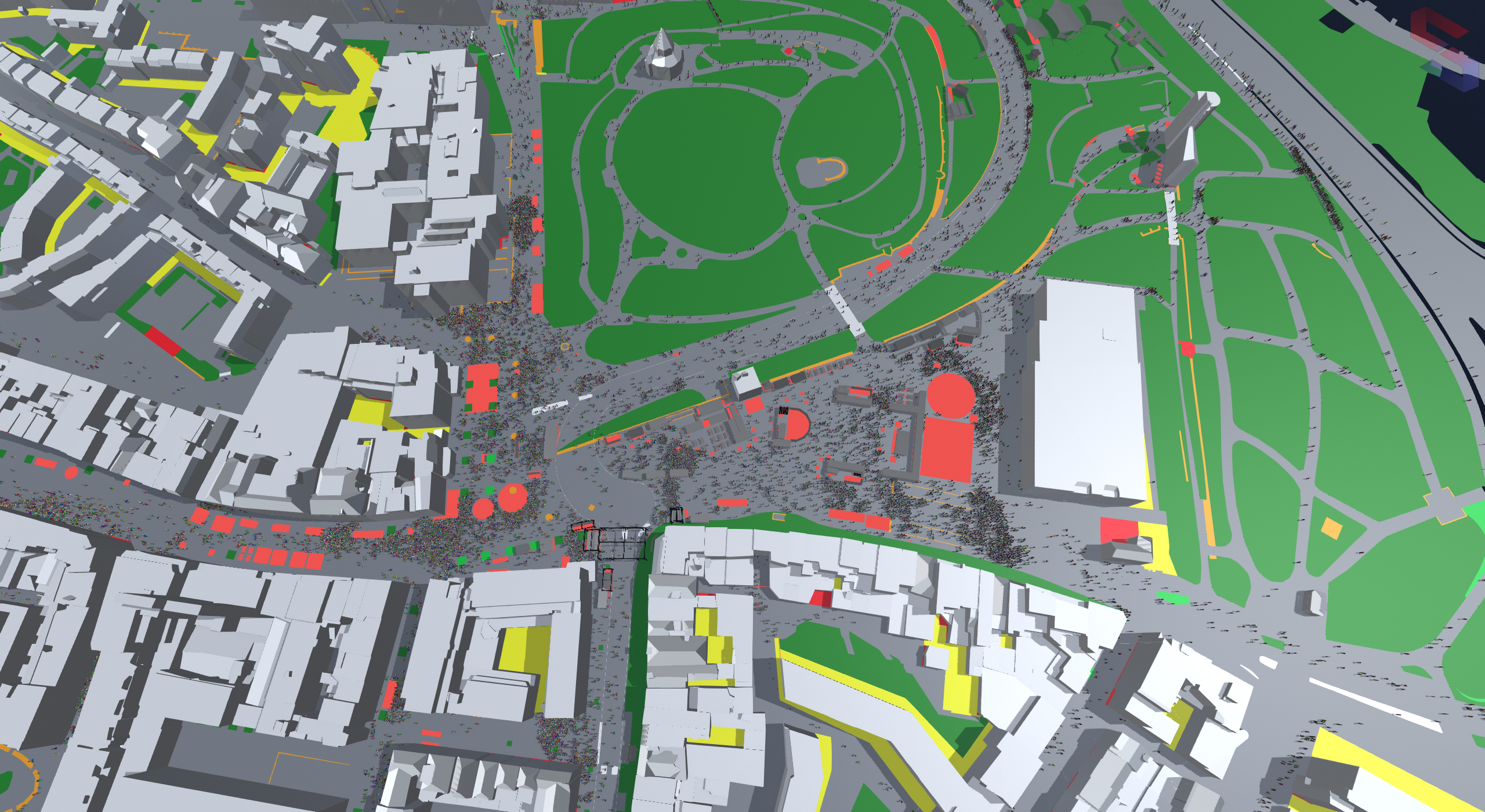
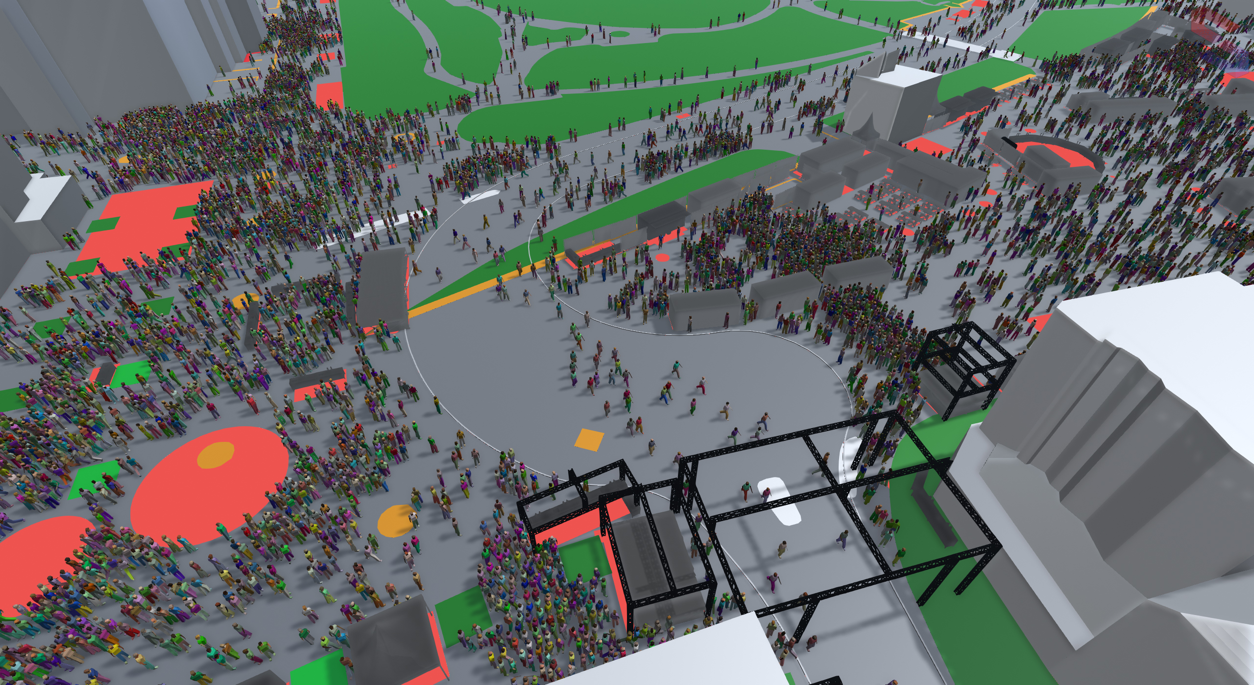
Successfully planning an event can be a daunting task, but with the help of #crowdsimulation tools, the process can be made much more manageable. The usage of crowd simulation solutions in digital twin cities provides insights into how people move around the city and interact with their surroundings and each other. For example, this can be used to study the flow of people through a space, identify bottlenecks and potential hazards, and test evacuation procedures. uCrowds’ pedestrian simulation software, SimCrowds, can be a powerful event planning tool. Here are a few tips on how to use crowd simulation to improve event planning:
Use crowd simulation to map out the flow of traffic. Before the event, use crowd simulation to map out the expected traffic flow. This will help to identify potential bottlenecks and plan for crowd management measures.
Use crowd simulation to plan for potential problems. No event is perfect, but pedestrian simulation can be used to anticipate and plan for potential problems. By identifying potential issues ahead of time, event planners can be better prepared to deal with them if they occur.
Use crowd simulation to evaluate different scenarios. Crowd simulation can be used to evaluate different scenarios for an event. This is particularly helpful if organizers are deciding between multiple event locations. By simulating different crowd scenarios, it can be easily seen which location will work best for a specific event.
Use crowd simulation to improve event security. Crowd simulation can also be used to improve event security. By identifying potential security risks, immediate steps can be taken to mitigate them. This can help ensure that the event is safe and secure for everyone involved.
Use crowd simulation to make the event planning process easier. Crowd simulation can be a helpful tool for making an event planning process more manageable. By using crowd simulation, organizers can save time and effort while still ensuring that your event is successful.
By providing the space for cooperation between several cutting-edge technologies such as Kadaster, Cyclomedia, Esri, AniVizzion, Genovum, Layhgo and uCrowds, unprecedented results can be seen in the field of digitalization of cities and the city of Nijmegen. The results do not only aid the municipalities in administering and asserting licenses and permits but they also ensure the safety and enjoyability of events and activities where it would be difficult to estimate and monitor where visitors flow or stop, creating possible bottlenecks. The overall aim is to enable digital twin technologies to be deployable and accessible nationwide, so that event organizers in the future can plan their events seamlessly in different cities.
Read, like and share this post on our LinkedIn!