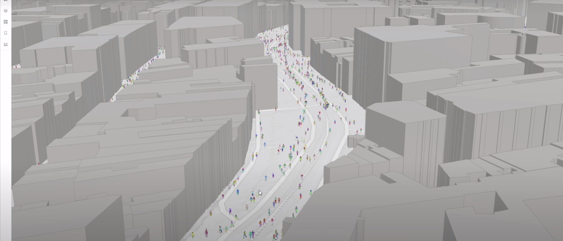
Crowd simulation integrated into 3D geospatial environments
Our technology stack enables browser-based crowd simulation solutions in your 2D or 3D geospatial environment. In this video, we showcase the integration of our technology into Esri’s ArcGIS online, demonstrating the simulation, visualization and animation of pedestrians in your favorite ArcGIS content within the browser. We also enhance the models by incorporating 3D photogrammetry environments.
Our interactive and dynamic simulation technology facilitates perspectives for actions and changes in your geospatial environment, unlocking accessible digital twin applications via your browser.
In our implementation, users can navigate to any location worldwide, selecting a region and its size. Our plugin then extracts potentially navigable areas and generates a crowd, with each pedestrian possessing individual goals and behavior sets. We plan to incorporate additional crowd logic controls to further specify behaviors, similar to those already available in SimCrowds.
Niels van der Vaart, overseeing Products, Technology and Innovation at Esri Nederland remarked, “It’s amazing to see realistic urban environments come to life with the real-time, interactive crowd simulation technology from uCrowds within ArcGIS!”
Through uCrowds, we animate your digital twin with simulation technology, offering insights, fostering collaboration, enlivening scenarios, and providing actionable perspectives.
Interested in exploring this new technology through a project? Contact us! To delve into simulations instantly, try out SimCrowds – get started in just one minute.
#crowd #simulation #digitaltwin #GIS #esri #arcgisonline #SimCrowds #photogrammetry
Read, like and share this post on our LinkedIn!