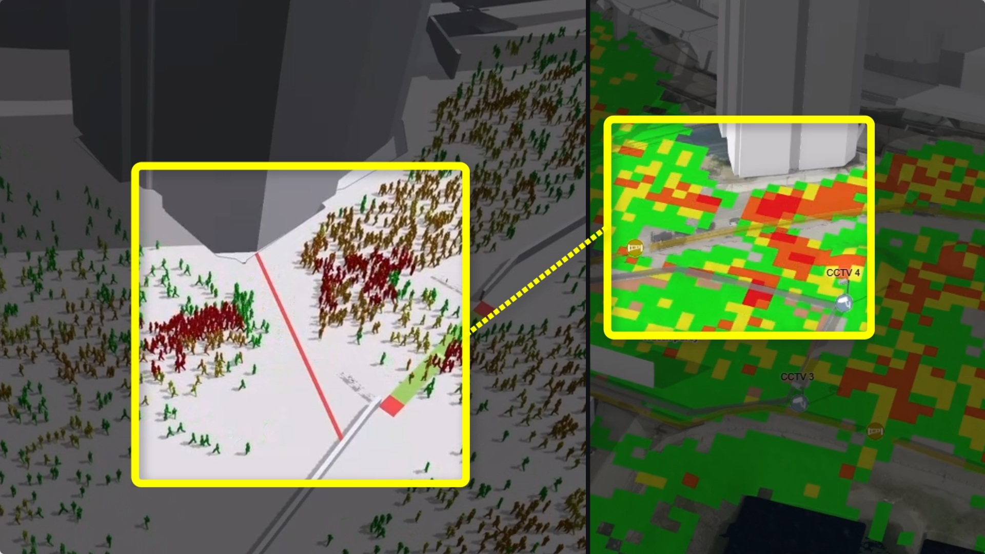
Predictive human movement analytics
How do you go from a static event layout to actionable insights about how tens of thousands of people will move?
Today, Esri published a blog post highlighting our joint work on bringing predictive human movement analytics to digital twins for large-scale events. We’re honoured to be featured, and especially proud that our collaboration was showcased during today’s Esri User Conference Plenary as the conference kicks off in San Diego.
The workflow is remarkably powerful:
Design the event in ArcGIS Create the event layout by combining authoritative GIS data with temporary event infrastructure such as stages, barriers, entrances, exits and restricted areas.
Build the digital twin The event is placed within an accurate 3D representation of the city, providing the spatial context needed for realistic analysis.
Simulate human movement Using uCrowds’ high-performance crowd simulation technology, realistic pedestrian behaviour is simulated based on visitor numbers, arrival patterns, destinations, routes and operational scenarios.
Generate predictive analytics Simulation results are transformed into intuitive outputs such as crowd density maps, bottleneck detection, walking times, flow rates and congestion hotspots, enabling organizers to evaluate “what-if” scenarios before the event even starts.
The strength of this approach lies in combining Esri’s geospatial intelligence with uCrowds’predictive crowd simulation. Instead of only visualizing an event, stakeholders can anticipate how people are likely to move, identify potential risks early, and evaluate alternative layouts before decisions are made.
As described in Esri’s blog, this creates a powerful planning workflow that supports safer events, better operational decisions and improved collaboration among organizers, municipalities and emergency services. It transforms a digital twin from a static 3D model into a living decision-support system capable of forecasting human movement.
A big thank you to the Esri team (Jay Fowler and Gert van Maren) for this collaboration and for highlighting our joint work. We’re excited to continue pushing the boundaries of predictive analytics for digital twins and public safety.
Blog post
Read the full blog here: https://www.esri.com/arcgis-blog/products/arcgis/public-safety/from-2d-plans-to-3d-intelligence-how-a-digital-twin-can-transform-safety-at-a-special-event
Contact
Get in touch with us at info@ucrowds.com to discuss how predictive human movement analytics can support safer and smarter decision-making.
#EsriUC #ArcGIS #DigitalTwin #CrowdSimulation #PredictiveAnalytics #GIS #PublicSafety #SmartCities #EventSafety
Read, like and share this post on our LinkedIn!